
Description
Batticaloa (Tamil: மட்டக்களப்பு, Maṭṭakkaḷappu; Sinhalese: මඩකලපුව, Madakalapuwa) is a major city in the Eastern Province, Sri Lanka, and its former capital. It is the administrative capital of the Batticaloa District. The city is the seat of the Eastern University of Sri Lanka and is a major commercial city. It is on the east coast, 69 miles (111 km) south by south east of Trincomalee, and is situated on an island. Pasikudah is popular tourist destinations situated 35 km northwest with beaches and flat year-round warm-water shallow-lagoons.
Etymology
Batticaloa is a Portuguese derivation. The original name of the region being the Tamil "Matakkalappu" (translation: Muddy Swamp). According to Mattakallappu Manmiyam (மட்டக்களப்பு மான்மியம்) the word Mattakkallpu consists Tamil words "Mattu" (மட்டு) Matta-derived from "Mattam" (மட்டம்) means 'flat' and geographical name KaLappu. Mukkuwa named this place as KaLappu-Mattam or boundary of lagoon later it became Matta-Kallappu or Flat Lagoon. Also, Batticaloa has a nickname, "Land of the singing fish" (Tamil: மீன் பாடும் தேன் நாடு) due to musical sounds that related to fish or aquatic creature in the Batticaloa Lagoon near the Kallady Bridge. BBC Radio 4 able to recorded the mysterious sound in Batticaloa Lagoon. The sound was broadcast by Sri Lanka Broadcasting Corporation in 1960s with the help of Rev. Fr. Lang, a Catholic priest.
Geography
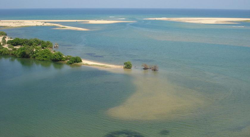
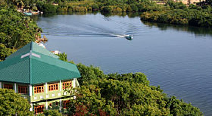
Batticaloa is in the eastern coast of Sri Lanka on a flat coastal plain boarded by the Indian Ocean in the east occupies a central part of the eastern Sri Lanka. Its average elevation is around 5 meters. Batticaloa district has three lagoons such as Batticaloa Lagoon, Valaichchenai Lagoon, and Vakari (Panichchankerni) Lagoon. Among these lagoon, Batticaloa Lagoon is the largest lagoon and has 56 km long 162 square km area, extending from Pankudaweli in North and Kalmunai in South.
There are several islands within the Batticaloa Lagoon such as Puliayantheevu, Buffaloa Island and Bone Island. Many bridges are built across the lagoon connecting the landmasses and the islands. The Puliayantheevu is the metropolitan place of the city. The biggest bridge of all is Lady Manning bridge located at Kallady, which is the main access path to the city from the southern places of the district. This bridge is also famous for Singing fishes which were considered as musical sounds heard in the Kallady lagoon on a full moon day. A priest named Father Lang recorded this musical charm and broadcast it in the 1960s over the (Sri Lanka Broadcasting Cooperation)
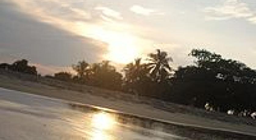
Batticaloa beaches are sandy and located along 4 km shoreline in the city and further extend through the neighboring places. They include Kallady beach, Pasikudah and Kalkudah. Pasikudah is a bay protected from the ocean, with a flat and sandy bed extending 150 to 200 meters from the shore.
Climate
Batticaloa has a tropical wet and dry climate under the Köppen climate classification, also generically referred to as 'dry-monsoonal climate'. Batticaloa's climate is temperate throughout the year. From March to May, the warmest time of the year, the maximum temperature averages around 32 degrees Celsius (88 degrees Fahrenheit). During the monsoon season from November to February heavy rains are recorded, with average temperature of 25 °C. Average annual rainfall in Batticaloa is 1,650.9 mm (65.00 in).
History
Early history
Ancient map drawn by Egyptian cartographer Ptolemy shows the Eastern Province and Batticaloa as Nagadiba. Thus the people of the Eastern Province were called Nagas. There were several Naga kings and princes who ruled Sri Lanka and Nagadeepa who were called by various Naga names. These names are listed references in Mahawamsa.
Mannar was the first capital established by Prince Vijaya (the Malla who was expelled by his father from Singapura) around 500 BC. His son Pandukaabahya moved the capital to Anoora. Ptolemy's map shows this location as Anoor and it remained with the name for a long time. Most probably it was Anaiyoor meaning Elephant-town. Later the capital grew into a city and name was changed into Anuradhapura. There were places called Malae meaning Malai or Mountains for the Hill Country. Jaffna and Point Pedro were marked as emporium showing that it was the Manchester of the East. Roghana was the name of the South. Mahaweli Ganga's old name was Ganges. Trincomalee's old name was Naga Diba. Western part was named Soena (Sonaka or Mashonaland) and East was named Senni (Valaichenai).
Karikala Chola invaded and took thousands of prisoners. Gajabahu went to Chola Nadu and brought those prisoners and their descendents back. Along with the released prisoners, thousands of Tamils were brought and settled. They were settled in the Eastern, Western and Central Provinces.
Mattakallappu Manmiyam refers (மட்டக்களப்பு மான்மியம்) Mukkuva or Mutkuhar are known as the first people migrated to this land and constructed seven villages in various areas. They immigrated their people from India and established the kingdom of Mukkuva. The name of the villages and towns in Batticaloa still holds the historical evidence of the ancient batticaloan people. When Mutkuhar intruded through the salty water and reached the destination of their voyage at the forests situated around the lagoon. When they finished. The name given by the Mukkuva was "Kallpu-Mattam" which literally means "boundary of lagoon". Later it was called "Matta-Kallappu" which indicates the destination of Mukkuva's voyage and the water is flat.
Mukkuva wars
Mukkuva is a coastal community from Ancient Tamil country. They are of mixed origin and migrated at various periods in history. Mukkuvas waged war around Puttalam and settled in the western coast as well. Sinhala Kings of Suryawamsa kept Mukkuvas as their mercenary force. They waged wars on other countries like Burma. Gajabahu, Parakramabahu, Vijayabahu were some of these Suryawamsa kings who employed the Chera soldiers for their protection and defence of Sri Lanka. Gajabahu I was a friend of Cheran Chenkuttuvan and was mentioned in the great Jain epic of Silappadikaram and in addition to that he was also mentioned in Mahawamsa.
When Anuradhapura was destroyed, the capital moved from Anuradhapura to Polonnaruwa. When Pollonaruwa was destroyed the capital moved to Kotte and then to Kandy. Anuradhapura was destroyed by Rajaraja Cholan and he who established Polonnaruwa. Even though Pollonaruwa had a few Hindu temples it was a great Buddhist city full of beautiful Buddhist architecture matching Angkor Wat.
Kalinga Magha
As a catalyst for change, Kalinga Magha is arguably one of the most significant rulers in Sri Lankan history. His invasion marks the final – cataclysmic – destruction of the kingdom of Rajarata, which had for so long been the heart of native power on the island. The great cities of the ancient kings were now lost and disappeared into the jungle, and were not rediscovered until the 19th century. Native power was henceforth centred on a kaleidoscopically shifting collection of kingdoms in south and central Sri Lanka. The north, in the meanwhile, eventually evolved into the Jaffna Kingdom, which was subjected colonial rule by the Portuguese in 1619.
Kalinga Magha's geopolitical impact is reflected in the changing language of the Culavamsa as well. The traditional divisions of Sri Lanka, into Rajarata, Dhakkinadesa, and Ruhuna, first undergo a change of names (Rajarata becomes Pathithadesa, Dhakkinadesa becomes Mayarata), and then slip into obsolescence altogether. Their successor kingdoms tended to be geographically smaller and centred on a strong citadel-capital, such as Yapahuwa or Gampola; they also tended to be much short lived, like Sitawaka.
Jaffna principality
With the decline of the Rohana sub-kingdom and the defeat of Polonnaruwa, coming with the rise of Chola power, i.e., from about the 13th century CE, these regions became wild. The many irrigation works (tanks etc., which exist even today) became home to malaria. In the meantime, the eastern coastal region remained less affected by Malaria and began to be occupied. Thus seafaring people who had begun to settle down along the coast since the Anuradhapura times, c. 6th Century CE began to flourish. The forests continued to be dominated by the Veddha population which claimed kingship ("cross-cousins") with the Sinhala kings of Kandy.
Parakramabahu's coronation took place in 1236. He turned his attention to the recovery of Polonnaruwa from the Tamils, and achieved this purpose by 1244. In this connection two kings are mentioned, Kalinga Magha and Jaya Bahu, who had been in power forty years, apparently reckoned from the time of the military rule after Sahasa Malla. As the Tamil war' and the `Malala war' as specifically mentioned by contemporary chronicles the two kings may have held different parts of the country. In the king's eleventh year (1244/5) Lanka was invaded by Chandrabhanu, a Javanese (Javaka) from Tambralinga, with a host armed with blow-pipes and poisoned arrows: he may have been a sea-robber, and though now repulsed descended on the Island later on.
The rest of the reign according to the contemporary records was spent in pious works; the king also held a convocation for the purpose of reforming the priesthood, whose discipline had been relaxed during the Tamil occupation. The chronicles make no mention of a great Pandyan invasion which seems to have taken place between 1254 and 1256, in which one of the kings of Lanka was slain and the other rendered tributary. From this it is clear that Parakramabahu never had recovered the north of the Island, which certainly had been held by his great namesake.
King Parakramabahu II got organized for a major battle. He got everything ready hastily. Those were very busy days for the king and his Yuvaraja Buwanekabahu was always with him, helping him in whatever way he could. The Yuvaraja was fully committed to his task. He was a great Sinhala leader who was very nationalistic in his deeds. All other warriors too did their best. One and all they were all prepared even to sacrifice their lives to win the freedom for the country.
Time passed. The Sinhala soldiers were mastering martial arts. They were physically strong. The king was greatly pleased to witness all this. The auspicious hour arrived. The army of King Parakramabahu II set out on their march towards 'Pihiti-rata.' There were a number of check points put up by the Keralas on this route. King Parakramabahu's army destroyed them all. By this time, there were about 40,000 Kerala soldiers in the country. They were real warriors but the Sinhala army was skilled enough to face them. They started attacking the Kerala camps, left and right.
This was no easy task. The Sinhala soldiers did not retreat. They used all their strategies until the Kerala soldiers were completely weakened. The Sinhala forces were victorious. All Kerala camps were destroyed. Ultimately they reached Polonnaruwa, besieged the city and began to attack. Before long the Polonnaruwa kingdom was won by Parakramabahu II.
However, as the entire 'Raja-rata' was not freed completely, the king did not go to live there. It is during this time, around 1258 AD, in the 22nd year of his rule, the king was afflicted with an incurable disease.
European colony
Portugal
Lourenço de Almeida, the Portuguese Admiral for India invaded Ceylon and made it a part of Portuguese colony. They simply looted all the spices and made a hundred times profit. They interfered in local politics and they introduced Catholic religion. They destroyed all the temples and vharas. They killed all the monks. Only 4 Buddhist priests were living at the time of Portuguese rule. Global free trade was hampered by these new colonisers.
Batticaloa principality
Lanka was a confederacy of various rulers for a long time and different princes ruled the different provinces and helped each other and plotted against each other. As the Portuguese colonisers were dividing and ruling Kotte, Kandy Kingdom and Jaffna Kingdom had to create a confederacy to fight against Portugal. As a joint strategy they approached the Netherlands to have a global free trade and to get rid of the Portuguese.
From Cape Comorin the Dutch Admiral Spitzburgen steered his course to Point de Galle ; but, without landing there or at any of the other places which were strongly fortified by the Portuguese, he sailed round the south coast of the Island and made for Batticaloa, where he anchored on 31 May 1602. He learnt that the town of Batticaloa, where the chief of the province resided, was about three miles (5 km) inland ; so he sent him a messenger proposing to enter into trade with him. In the meantime he learnt from some Tamils who came on board that there was plenty of pepper and cinnamon to be had, but that it was to be obtained from the chief of the place. These Tamils brought with them a Portuguese interpreter; for Portuguese was the only European language then heard or spoken in Ceylon, and the natives of the island had no idea that there were other white people who spoke a different language.
The Admiral was taken from Batticaloa to Kandy and was given a liberation hero's welcome as King Rajasinghe seized the opportunity to get rid of the Portuguese, the oppressors who were slowly encroaching the island systematically and promoting subversion against Rajasinghe.
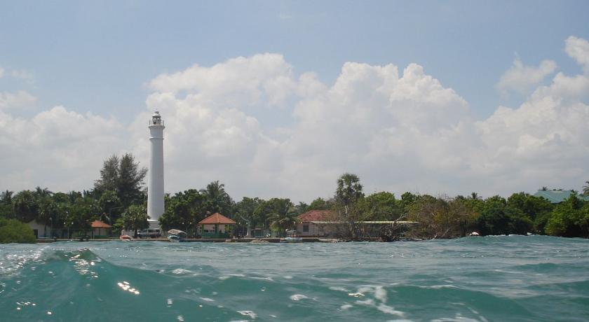
The Batticaloa fort was built by the Portuguese in 1628 and was the first to be captured by the Dutch (18 May 1638). It is one of the most picturesque of the small Dutch fort of Sri Lanka, it’s situated in an island, still in good condition.
World War II
In 1942, during World War II, the aircraft carrier HMS Hermes and escorting destroyer HMAS Vampire were stationed at Trincomalee. Both these ships came under Japanese aerial attack off Batticaloa and were sunk. Some of the remnants of HMS Hermes still remain at around 9 nautical miles (17 km) off Baticaloa.
Modern Batticaloa Town
The city has four main divisions.
- Puliyanthivu: Seat of many government department and offices, schools, banks religious places, General Hospital, Weber Stadium and Shops. It was a place for NGO offices including ICRC, UN, UNICEF, World Vision, etc.
- Koddamunai: Schools, Banks, Sri Lanka Telecom regional office for East, Shops and many government offices are located. Two bridges called Perya Palam and Puthuppalam are connects Pulianthivu island with Koddaminai land mass.
- Kallady: Here there are many Government buildings and private industries, schools, hospitals and Eastern University Medical Faculty. Kallady Lady Manning bridge connects Kallady and Arasay.
- Puthur: This is where the domestic airport of Batticaloa is located.
Demography
Batticaloa is on the East coast of Sri Lanka, 314 km from Colombo. The population of 95,489 consists mainly of Sri Lankan Tamils, Moors, Sinhalese, Burghers and the indigenous Veddas population.
The District of Batticaloa itself consists of several administrative divisions, which are: Manmunai North, Manmunai West, Manmunai South & Eruvil Pattu, Manmunai Pattu, Koralai Pattu North, Porativu Pattu, Kattankudy, Eravur Pattu, Eravur Town, Koralai Pattu and Koralai Pattu West. Some 525,142 persons (52.2% female) were recorded in the 2012 census. Religion-based statistics in the year 2012 are: Hindus 64.6%, Muslims 25.5%, Christians 8.8%, with a small numbers of Buddhists (1.1%) and others. These figures became even more polarized towards Hindus during the LTTE occupation which came to an end in 2007 (see Eelam War IV).
According to the 2012 census, the total population was 525,142. Of which 381,285 were Sri Lankan Tamils, 133,844 Moors, 6,127 were Sinhalese, 2,794 Burgher, 1,015 Indian Tamils, 58 Veddah, 16 Malay, and 3 Sri Lanka Chetty.
Cultural institutions
Batticaloa has historically been a centre of Portuguese Burgher culture, supported in the modern era by the Catholic Burgher Union. In the 1980s, despite Burger emigration to Australia, the Union still numbered some 2,000 speakers of Sri Lankan Portuguese, making them the largest community still speaking the dialect.
Religious institutions
Hinduism is the major religion of Batticaloa. Eastern Province is a place of Amman temples. This shows the worship of female deity Kannaki of Silappatikaram. The cult has come with the King Gajabahu I who brought the settler Tamils from the Chera Kingdom of his friend Cheran Senguttuvan. Silppatikaram copy was initially discovered in Trincomalee by Tamil scholars. Tamil Nadu was not having a copy of this great Jain literature. The northern and eastern parts of Sri Lanka have several temples in honour of Kannaki Amman. Gajabahu I brought Amman worship to Sri Lanka in the Third Century AD after her death.
Shri Mamangeshwarar Kovil is one of the main holy places for Hindus in the country is located in a place called Amirthakally which is 6 Kilometers away from Batticaloa town. Hindus believe that by bathing in the water of sacred water of Mamangeshwarar tank, the departed souls of their family will be receiving better attainments in their cycle of its transmigration. Sri Kandaswamy/KannakaiAmman Kovil are important from a devotional point of view. The Mandur (மண்டூர்) temple is in the southern end, while the Mamangeshwarar temple is in the western-most edge at Muhaththuvaram (முகத்துவாரம்).
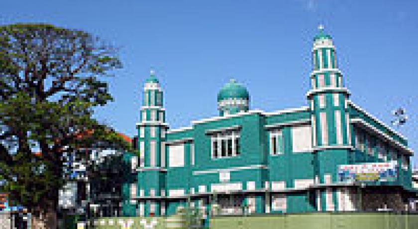
The Colany Mosque, and the Koddamunai Dharga and Madrasa are two noteworthy Muslim institutions. There are a large number of mosques in the region.
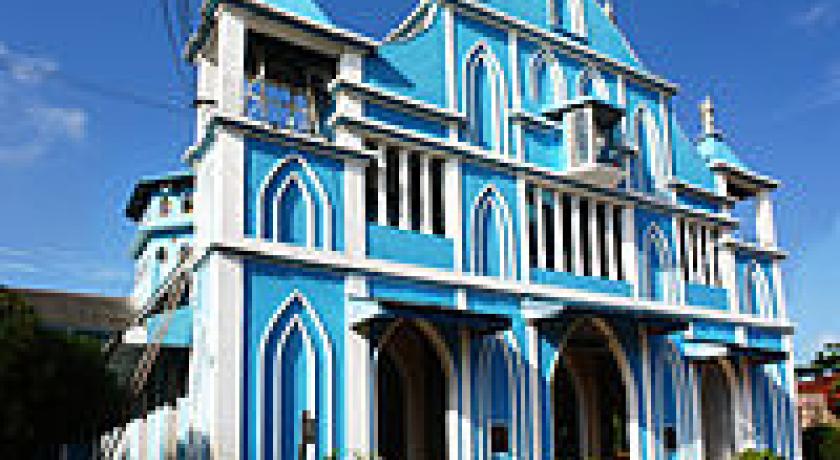
Christianity is present and Catholic churches are found every where as the coastal community has some Catholics. During the colonial influences, Catholic was introduced to Batticaloan, and the first Catholic church in Batticaloa was established in 1624. The Catholic Church has a diocese headquartered in the city. Methodists, Anglicans, and other Protestants and their schools are also present in Batticaloa. Within Batticaloa Municipal Council area, Christian presence is strong (23%) compare to other area.
The latter is a historic harbour and ancient Buddhist shrine, mentioned in the "Dhathu Vamsa". While the Dagaba and shrine in the Dutch Fort is the oldest (1st century CE), Mangalaramaya is a well-known modern Buddhist temple in Batticaloa.
Economic activities
Rice and coconuts are the two staples of the district, and steamers trading round the island call regularly at the port. The lagoon is famous for its "singing fish," supposed to be shell-fish which give forth musical notes. The district has a remnant of Veddahs or wild men of the wood. Prior to the Sri Lankan civil war, there were large-scale shrimp farms as well as fish and rice processing activities. Batticaloa shows a huge potential for tourism related industries.
Transport
Batticaloa is the terminus of a Broad gauge branch railway of the Sri Lanka Government Railway network. The Batticaloa railway station is the last station on Batticaloa Line. Batticaloa Airport is a military air force base, which has domestic air service to civilian as well by Cinnamon Air and Helitours. Bus service is available to major cities of Sri Lanka.
Source:https://en.wikipedia.org/wiki/Batticaloa
Address
Batticaloa
Sri Lanka
Lat: 7.730997086 - Lng: 81.674728394

