


Description
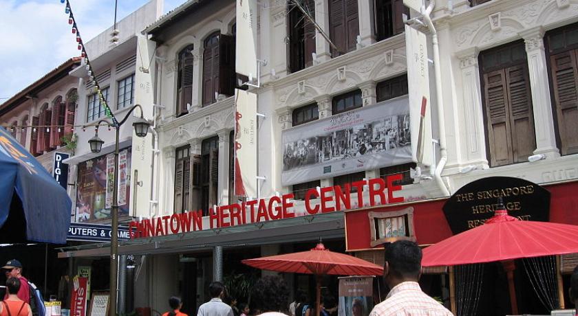
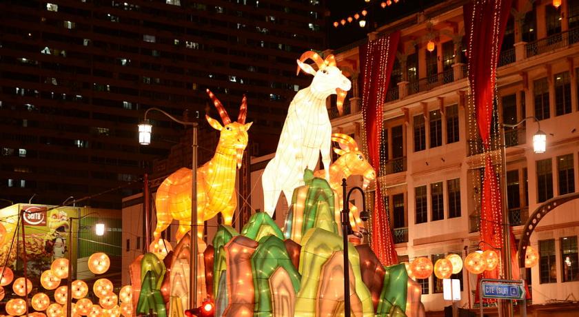
Chinatown (Chinese: 牛车水, Malay: Kreta Ayer, Tamil: சைனா டவுன்) is a subzone and ethnic enclave located within the Outram district in the Central Area of Singapore. Featuring distinctly Chinese cultural elements, Chinatown has had a historically concentrated ethnic Chinese population.
As the largest ethnic group in Singapore is Chinese, Chinatown is considerably less of an enclave than it once was. However, the precinct does retain significant historical and cultural significance. Large sections of it have been declared national heritage sites officially designated for conservation by the Urban Redevelopment Authority.
Etymology
The name Chinatown was used by the British.
Singapore's Chinatown is known as Niu che shui (Chinese: 牛车水; pinyin: Niú chē shuǐ; literally: "cow car water") in Mandarin Chinese, Gu Chia Chwi in Hokkien and Ngau-che-shui in Cantonese - all of which mean "bullock water-cart" - and Kreta Ayer in Malay, which means "water cart". This is due to the fact that Chinatown's water supply was principally transported by animal-driven carts in the 19th century. It should be noted that while these names are sometimes used for referring to Chinatown in general, they actually refer to the area of Kreta Ayer Road.
Geography
Chinatown consists of 4 distinctive sub-areas which were developed at different times.
- Telok Ayer - developed in the 1820s.
- Kreta Ayer - developed in the 1830s
- Bukit Pasoh - developed in early 1900s
- Tanjong Pagar - developed in the 1920s
History
Development
Wang Dayuan visited Singapore (then called Temasek or Dan Ma Xi) in 1330 and recorded that there was a Chinese community.
Under the Raffles Plan of Singapore, the area originally was a division of colonial Singapore where Chinese immigrants tended to reside. Although as Singapore grew, Chinese immigrants settled in other areas of the island-city, Chinatown became overcrowded within decades of Singapore's founding in 1819 and remained such until many residents were relocated at the initiation of Singapore's governmental Housing Development Board in the 1960s.
In 1822, Sir Stamford Raffles wrote to Captain C.E. Davis, President of the Town Committee, and George Bonham and Alex L. Johnson, Esquires, and members, charging them with the task of "suggesting and carrying into effect such arrangements on this head, as may on the whole be most conducive to the comfort and security of the different classes of inhabitants and the general interests and welfare of the place..."
He went on to issue instructions, as a guide to the Committee, which included a general description of Singapore Town, the ground reserved by the government, the European town and principal mercantile establishments and the native divisions and "kampongs". These included areas for Bugis, Arabs, Indians, Malays and Chinese kampongs. Raffles was very clear in his instructions and his guidelines were to determine the urban structure of all subsequent development. The "five-foot way", for example, the continuous covered passage on either side of the street, was one of the public requirements.
Raffles foresaw the fact that "it may be presumed that they (the Chinese) will always form by far the largest portion of the community". For this reason, he appropriated all of the land southwest of the Singapore River for their accommodation but, at the same time, insisted that the different classes and the different provinces be concentrated in their separate quarters and that these quarters, in the event of fire, be constructed of masonry with tiled roofs.
This thus resulted in the formation of a distinct section titled Chinatown. However, only when parcels of land were leased or granted to the public in and after 1843 for the building of houses and shophouses, did Chinatown's physical development truly begin.
Legacy
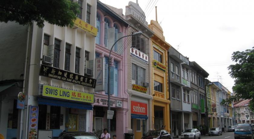
The legacy and diversity of Chinatown are still present. The Hokkiens (Fukiens) are associated with Havelock Road, Telok Ayer Street, China Street and Chulia Street, and the Teochew merchants are mostly in Circular Road, River Valley Road, Boat Quay and South Bridge Road. The ubiquitous Cantonese are scattered around South Bridge Road, Upper Cross Street, New Bridge Road and Bukit Pasoh Road. These days, the Hokkiens and Teochews have largely scattered to other parts of the island, leaving the Cantonese as the dominant dialect group in Chinatown.
The Chinese names of Pickering Street are Kian Keng Khau (mouth of the gambling houses) or Ngo Tai Tiahn Hok Kiong Khau (mouth of the five generations of the Tian Hok Temple).
Guilds, clans, trade unions and associations were all referred to as kongsi, a kind of Chinese mafia, although the literal meaning of the word is "to share". The so-called mafia is better translated as the secret and sinister hui. However, these secret societies, the triads, who themselves had suffered under the Manchus in China, provided support to the later immigrants to Singapore by paying their passage and permitting to pay it off by working.
There were the letter writers of Sago Street—the Chinese called this street Gu Chia Chwi Hi Hng Cheng (front of Kreta Ayer Theatre), but it was mainly associated with death—the sandalwood idols of Club Street and the complicated and simple food of Mosque Street; all rang to the sound of the abacus. Old women could be seen early in the mornings topping and tailing bean sprouts, the skins of frogs were being peeled, the newly killed snakes being skinned and the centuries-old panaceas being dispensed by women blessed with the power of curing.
In the heart of this diverse Chinese community is an important temple for Singaporean Tamils, the Sri Mariamman Hindu Tamil Temple, and mosques, Al-Abrar Mosque at Telok Ayer Street and Jamae Mosque at Mosque Street, as well as the Fukien Thian Hock Keng Chinese Temple of 1830 to 1842. These temples catered to the pockets of non-Chinese residents in the area and show that despite efforts to segregate the early immigrants; they had no qualms living together side by side.
Politics
Chinatown falls under both Tanjong Pagar GRC and Jalan Besar GRC. Singapore's first Prime Minister Mr. Lee Kwan Yew was one of the 3 MPs for that area before his death in March 2015. His successor as MP is Ms Indranee Rajah and the Jalan Besar GRC part of the area is served by Dr Lily Neo and Ms Denise Phua.
Street name origins
- Mosque Street is named after Jamae Mosque, located on the South Bridge Road end of the street. The mosque was completed in 1830 by the Chulia Muslims from the Coromandel Coast of South India but also used by the Malay Muslims living in the area. In the early years, Mosque Street was the site of ten stables.
- Pagoda Street takes its name from the Sri Mariamman Temple. During the 1850s and 1880s, the street was one of the centers of slave traffic. It also had its share of coolie quarters and opium smoking dens. One of the traders was Kwong Hup Yuen who, it is thought, occupied No. 37, and after whom Pagoda Street is often referred to today.
- Sago Lane and Sago Street got their names because in the 1840s there was a number of sago factories located there. Sago is taken from the pith of the rumbia palm and made into flour that is used for making cakes both sweet and savoury. Dead bodies are taken to Sago Lane.
- Smith Street was probably named after Sir Cecil Clementi Smith, who was the Governor of the Straits Settlements between 1887 and 1893.
- Temple Street refers to the Sri Mariamman Temple, which is located at the South Bridge Road end of the street. It was formerly known as Almeida Street after Joaquim d'Almeida, son of José D'Almeida, who owned some land at the junction of Temple Street and Trengganu Street. In 1908, the Municipal Commissioners changed its name to Temple Street to avoid confusion with other streets in Singapore which were also named after D'Almeida.
- Trengganu Street, described as "the Piccadilly of Chinese Singapore" in the past, now forms the heart of the tourist belt in Chinatown. In Chinese, it is called gu chia chui wah koi, or "the cross street of Kreta Ayer". The crossing of streets refers to Smith Street and Sago streets. The street name is derived from Terengganu, a state in present-day Peninsular Malaysia.
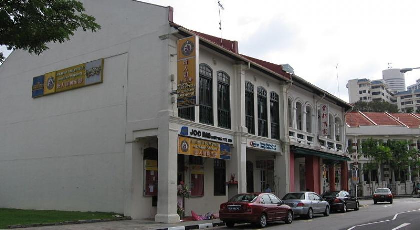
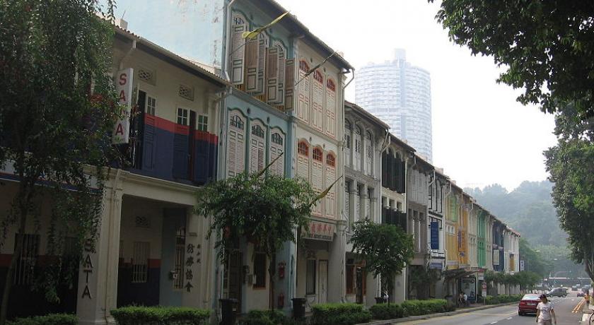
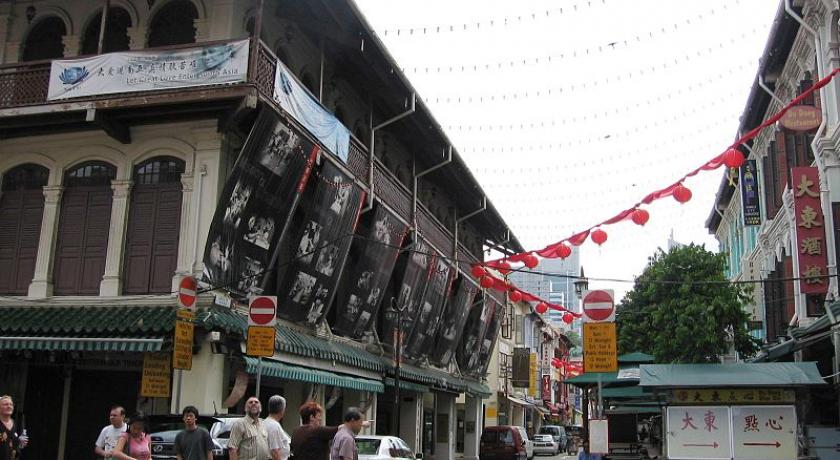
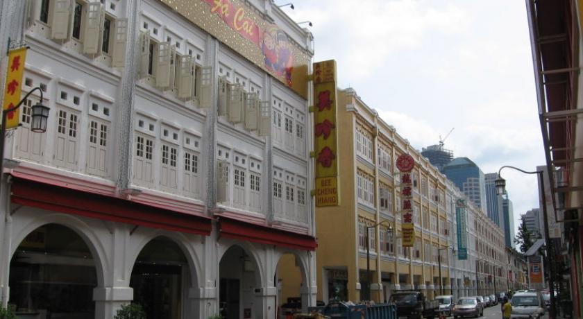
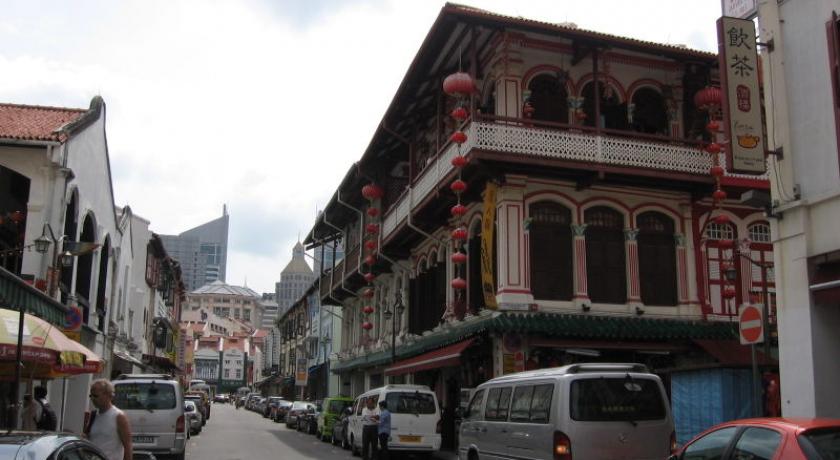
Architecture
The street architecture of Chinatown's buildings, the shophouses especially, combines different elements of baroque architecture and Victorian architecture and do not have a single classification. Many of them were built in the style of painted ladies, and have been restored in that fashion. These styles result in a variety of different colours of which pastel is most dominant. Trengganu Street, Pagoda Street and Temple Street are such examples of this architecture, as well as development in Upper Cross Street and the houses in Club Street. Boat Quay was once a slave market along the Singapore River, Boat Quay has the most mixed-style shophouses on the island.
In 1843, when land titles were issued, the terraces in Pagoda Street (now with additions, mostly three-story) were born. They were originally back to back, an arrangement which made night soil collection difficult, but lanes were developed in between following the Singapore Improvement Trust (SIT) Back lane orders of 1935.
The architectural character of many of the terraces in Chinatown is much more Italianate in style than those of, for instance Emerald Hill or Petain Road. Windows often appear as mere slits with narrow timber jalousies (often with adjustable slats). Fanlights over the windows are usually quite decorative and the pilasters and balconies and even the plasterwork and colours seem to be Mediterranean in flavour. The style was probably introduced by those early Chinese immigrants (both China-born and Straits-born) who had knowledge of the Portuguese architecture of Macau, Malacca and Goa. The Chettiars and Tamils from Southern India would also have been familiar with the European architecture there, although it is difficult to imagine how these people would have had a particularly strong influence on building in Chinatown.
Today
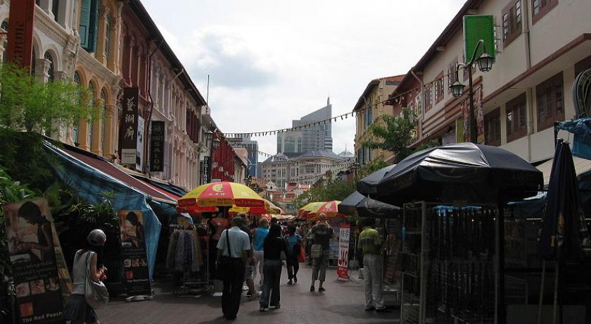
The cramped five-foot-ways, dingy alleys and raucous street hawkers are relics of Chinatown’s past.
Yet pockets of history remain in Chinatown, along with more modern sights. You could easily spend a few days wandering through these still-narrow streets.
Family-run goldsmiths, medicinal halls and teahouses ply their trades next to sleeker neighbours such as hipster bars and lifestyle shops.
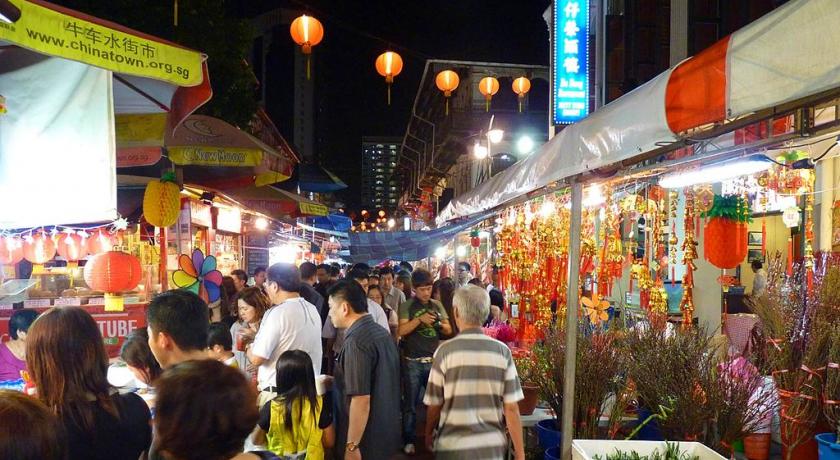
If you’re a foodie, try 'char kway teow' (stir-fried noodles) and 'satay' (barbecued meat skewers) at Chinatown Food Street, a row of hawker stalls, shophouse restaurants and kiosks along Smith Street.
For trendier tastes, chic restaurants and bars are in Neil Road, Duxton Road and Keong Saik Road. The vibe is electric in Club Street and Ann Siang Road on Friday and Saturday nights, when locals and expats head down for dinner and drinks.
Stay
To rest that weary head, stay at a boutique hotel in Duxton Road, Keong Saik Road and Ann Siang Road. For budget stays, try Trengganu Street, Mosque Street and Temple Street. Beautifully restored, the trendy New Majestic Hotel in Bukit Pasoh Road has 30 chic rooms and an award-winning restaurant.
Best of all, there’s free Wi-Fi throughout the Chinatown area so you can continue to be plugged in while you sightsee, shop and eat.
There is a range of guided tours that leave from Chinatown Visitors’ Centre.
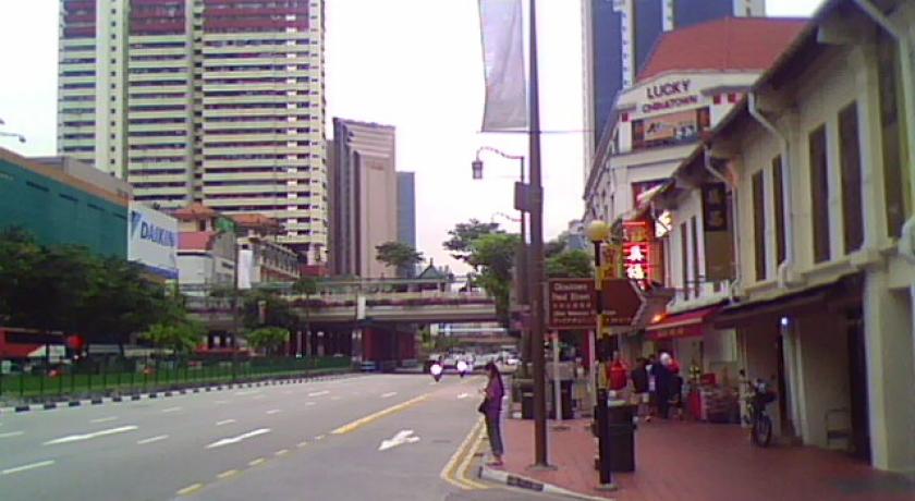
Transportation
The Mass Rapid Transit MRT serves the area at Chinatown MRT Station on the North East and Downtown Lines, in the middle of pedestrian-only Pagoda Street, and serves the vicinity, as well as several public bus routes which integrate it into Singapore's transportation system. Also nearby are the Tanjong Pagar MRT Station on the East West MRT Line; Outram Park MRT Station, an interchange between the East West Line and North East Line; and Clarke Quay MRT Station on the North East Line, as well as a bus terminal called New Bridge Road Bus Terminal.
Source https://en.wikipedia.org/wiki/Chinatown,_Singapore
http://www.yoursingapore.com/en.html
Address
Singapore
Singapore
Lat: 1.283895493 - Lng: 103.843460083

