
Description
The Central Area (Chinese: 新加坡中区, Malay: Zon Tengah, Tamil: சிங்கப்பூர் மாவட்ட), also called the City Area, and informally The City, is an area located in the south-eastern part of the Central Region of Singapore. The Central Area consists of 11 planning areas namely the Downtown Core, Marina East, Marina South, the Museum, Newton, Orchard, Outram, River Valley, Rochor, the Singapore River and Straits View, as defined by the Urban Redevelopment Authority.
The Central Area surrounds the banks of the Singapore River and Marina Bay where the first settlements on the island were established shortly after the arrival of Raffles in 1819. Surrounding the Central Area is the rest of the Central Region. The Central Area shares boundaries with the planning areas of Novena to the north, Kallang to the north and north-east, Tanglin to the north-west and west, Bukit Merah to the south-west and Marine Parade to the east. The south-easternmost limits of the city are enclosed in by Marina Barrage, where the mouth of Marina Bay meets the Singapore Strait.
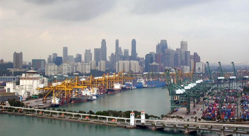
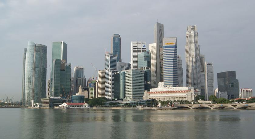
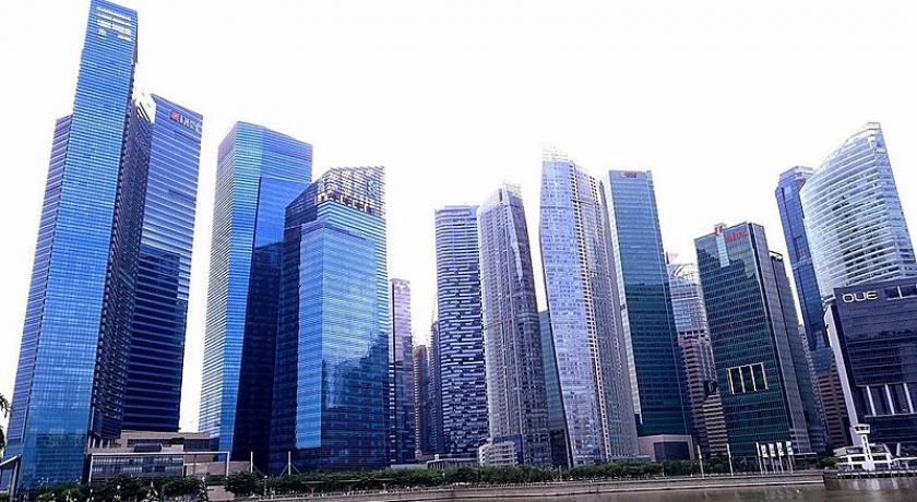
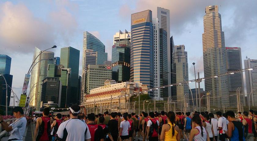
The Central Area is one of the most densely developed places in Singapore, with a large mix of commercial and residential developments packed into a space of only 1784 hectares. A great number of Mass Rapid Transit stations tend to be concentrated in this area as well, especially interchange stations and stations along the Circle MRT Line. Each of the districts within the Central Area has a heavy and dense commercial presence, especially in the Downtown Core, Orchard and Singapore River districts. Rochor, Newton, River Valley and Outram are commercially thriving, but have fewer skyscrapers and generally include a more substantial residential presence. Schools, condominiums and Housing Development Board apartments are located in these areas, albeit at higher prices.
Since the 1970s, the Singapore government and the Urban Redevelopment Authority have reclaimed land portions from Marina Bay in an attempt to expand the Central Area. Newly created portions of land surrounding Marina Bay have been organised and labeled into Marina East, Marina South and Straits View. Many construction projects have been completed in these districts since their creation, but most of them are still under consolidation or development.
History
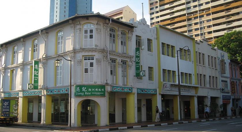
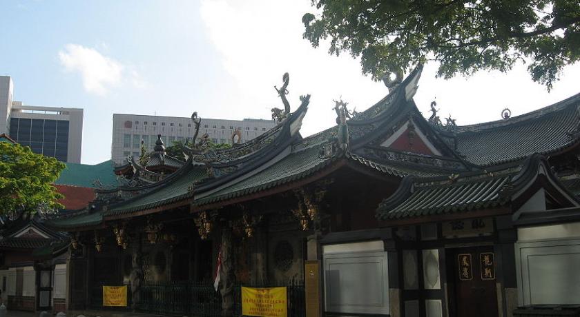
Much of the central area bounded by Telok Ayer Road, which has a high concentration of skyscrapers, is built on reclaimed land. Therefore, the Thian Hock Keng Temple built in 1839 along Telok Ayer Road used to face the sea and it was visited by Chinese immigrants giving thanks to Ma Zu (Goddess of the Sea) for their safe voyage. Prior to 1839, the temple served as a joss-house for the Hokkien immigrants. This temple, which is also the first Hokkien temple to be built by the Hokkien clan under the leadership of Tan Tock Seng and Si Hoo Keh, is in the architectural style of southern China, using only materials imported from China and supported with no nails. The clan’s office was housed there and this temple was also used as a meeting venue. The construction of the temple was completed in 1842 and details of this temple’s history are recorded in granite tablets found on the wall inside the Entrance Hall. A plaque inscribed with the words Bo Jing Nan Ming (Gentle Waves over the South Seas) which was presented by the Guangxu Emperor in 1907, is found in this temple providing evidence of the temple’s stature. The temple comprises an architectural masterpiece of stone, tiles and wood, dragons and phoenixes, amazing cravings, sculptures and imposing columns. The Thian Hock Keng temple has been gazetted as a national monument in 1973.
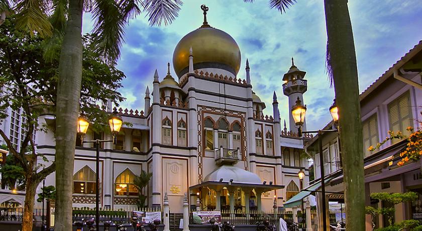
The adjacent placement of places of worship of various religions (such as the Thian Hock Keng Temple, Nagore Durgha, Singapore, the Central Christian Church and Al Abrar Mosque) and demonstrate the peaceful coexistence of the early multi-ethnic and multi-cultural communities in Singapore.
At Church Street is the Yueh Hai Ching Temple, one of the oldest Taoist temples, having been built in 1826. This temple was established by a group of Teochew settlers from Guangzhou in China when they dedicated a shrine to Tian Hou. This temple faced the sea and was therefore a place where newly arrived Chinese immigrants (sailors and travelers included) came to offer their thanks to the Goddess for their safe voyage across the seas. The renovation to the temple was undertaken by the Ngee Ann Kongsi, which was formed by a group of immigrants from the Teochew community. This temple served as a meeting place for the people of the Teochew community in the late 19th century when the Teochews became the second largest Chinese Dialect group in Singapore. The temple was honoured with a bian e, an imperial signboard from Emperor Guang Xu of the Qing Dynasty in 1907. In 1996 it was gazetted as a national monument and it underwent repairs and restoration works. This temple is a silent testimony to the faith and gratitude of many people in Singapore. The background contrast between the old temples and the new modern buildings indicate the juxtaposition and coexistence of new and old. The temple has a cover structure composed of models depicting the lives of Chinese villagers. The then-emperor of China also presented the temple with a signboard that is still displayed in the temple till today. The temple is separated into two sections; each section caters for the different people coming from the different parts of China.
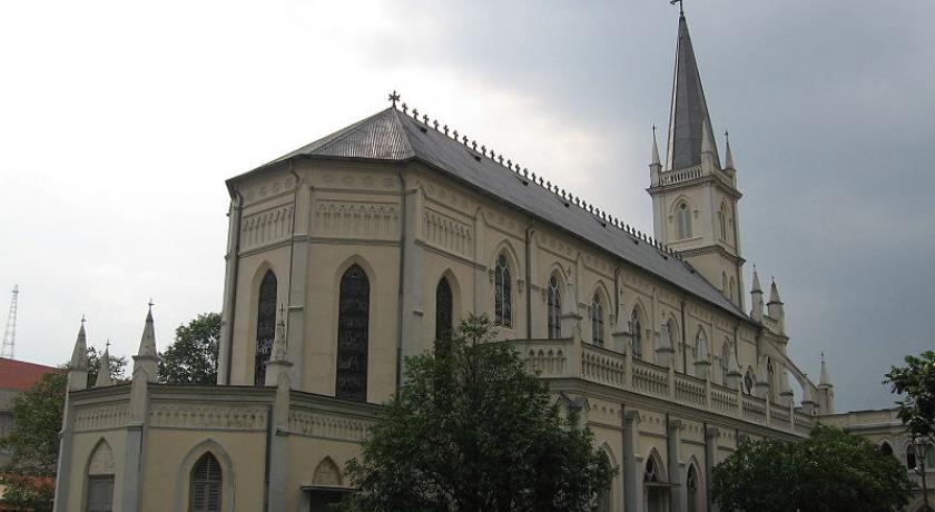
The Armenian Church, located at Hill Street, is the oldest church in Singapore. The funding for the building of the church came from contributions of the Armenian community. It was built in the 1830s by George Coleman, the architect of many buildings in Singapore, for a small Armenian community that once resided in Singapore. The Church was credited as a national monument.
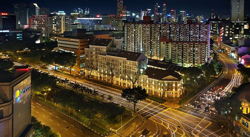
CHIJMES, located at Victoria Street, is currently converted into a modern dining area with restaurants. It was originally a Catholic Convent which was converted. The original structure was well preserved and the chapel is still present till today. The restaurants reside in the old structures of the convent.
The close locations of various places of religious worship indicated the peaceful coexistence of the early multi-ethnic and multi-cultural communities in Singapore.
The streets in the city have a long history which showed a very different city as compared to the present. History past; Ang Siang Hill was the site of remittance houses where the Chinese immigrants went when they wanted to remit money back home. Sago Lane (Street of the Dead) was formerly used as a place for people to die with the funeral parlor on the ground floor and living areas on the second floor. This area was infamous because of the large number of deaths found there. Although the Sago Street is referred to as the Street of the Dead, the funeral parlor was actually located in the Sago Lane. Sago Lane runs parallel to the Sago Street.
Land use
Over the course of its history, dating back to as far as the 18th Century, the land uses of the various regions of Singapore have changed over time. The mixed land use in the central area is unlike other regions in Singapore, housing both the old and the new side by side.
Shop houses on Ann Siang Hill, for example, have changed purposes over the years. In the past, these shop houses were used as clan houses for the various clans that existed in the Chinatown region. Due to a housing shortage exacerbated by the destruction of World War II, an HDB paper estimated that in 1966, 250,000 lived in squalid shop houses in the Central Area.
However, the regions closest to the core of the central area have continued to be upgraded and developed. In this region, though the physical structure may remain the same, the use has now been changed. Though there are still various clan houses there, alongside them are new offices and shops. Some shop houses have even adapted to house both the traditional and modern land uses in the same complex.
In the city centre, there are more skyscrapers and fewer shop houses. Despite the fact that there is a height limit of 280m, these skyscrapers are so dense that the density of offices here is among the highest in Singapore. There are several clusters throughout the region for the different business sectors – there are areas dedicated to the offices in fields of law and banking.
Significant landmarks
Commercial
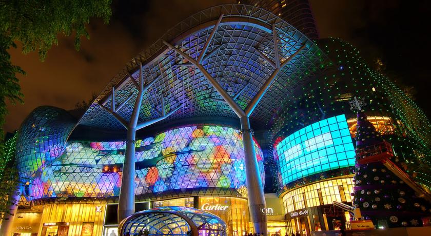
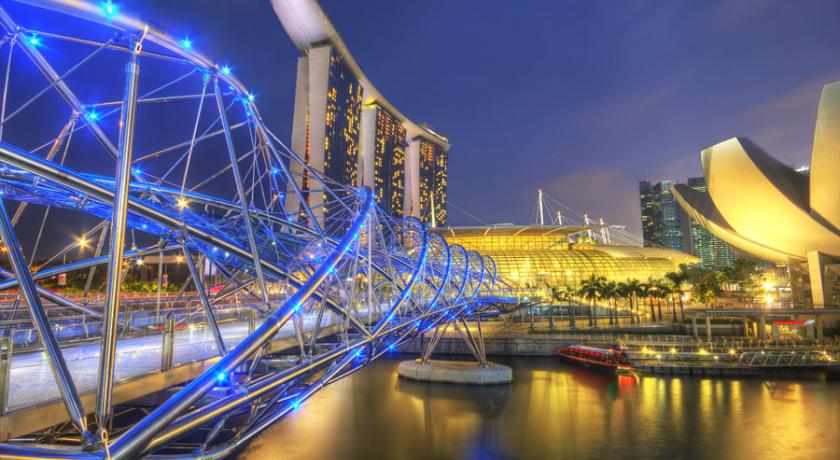
The Central Area comprises the core of Singapore's financial activities and thus includes many important and significant financial buildings. There are many skyscrapers in the Central Area. Skyscrapers in the city include the relatively new ones such as the UOB building and the Sail at Marina Bay, as well as the older but still well maintained and used buildings such as the Swissôtel The Stamford, which once held the title as the world's tallest hotel.
Majority of Singapore's tallest building are found in the city, where land is the most expensive in Singapore. However, due to aviation restrictions, buildings in the city cannot go higher than 280m. Most of the iconic buildings that represents Singapore city skyline also stand on free hold land, which is extremely uncommon in Singapore today.
Some commercial buildings reflect the cultural Chinese heritage of Singapore in addition to the presence of other cultural heritage sites in the Central Area. The UOB Plaza makes use of the traditional Chinese symbol of the octagon in its design, which supposedly brings about good Feng Shui according to traditional Chinese geomancy.
Cultural
Singapore's Central Area possesses some important cultural sites. Historical shop houses with their original façades preserved can be found along streets like Club and Ann Siang Streets. These shop houses have, however, been largely gentrified, displacing many of the original tenants, resulting in a loss of certain traditional trades such as crafts.
These shop houses were preserved as part of URA efforts to preserve the nation's cultural heritage. The façades are intact but the businesses operating inside today are now different, with law firms, design companies, insurance firms and bars and restaurants. These new companies fit into the old structures without too much alteration to the original façade. There are also shop houses that continue to serve as local clubhouses. Dates are present on the shop houses themselves to indicate date of construction, mostly in the 19th century.
Even though the shop houses today are filled with modern businesses and people, the cultural practices are still strong along these streets; for example, the hungry ghost festival, in which one can often see many shops laying out tables outside their shop house and offering prayers.
The city was the original location for many schools in Singapore, such as Anglo-Chinese School, Raffles Institution and Raffles Girls' School, Yeung Ching (Yangzheng) Primary School and Tao Nan School. These schools have since moved to newer locations.
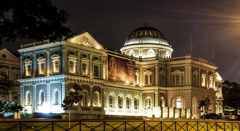
The Asian Civilisations Museum lies near the bank of the Singapore River, and it is a cultural landmark that has been preserved since colonial times. This building is otherwise known as the Empress Place Building. It was converted to a museum in 2003. The Peranakan Museum is also nearby along Armenian Street. This building is the Old Tao Nan School, and since early 2008 has been specialising in Peranakan culture.
The city is very much rooted to the cultural traditions of the Chinese, such as the Chinese geomancy or Feng Shui, which is present in many buildings. The Furama City Hotel, for example, has a roofline which resembles the open palm of the hand to ward off evil. The ‘Fountain of Wealth’ at the Suntec Tower has the inward flowing water at the fountain for two reasons. Water is the symbol of life and wealth in Chinese culture and the inward motion of the water signifies the retention of wealth for Suntec City. According to feng shui experts, the water which flows inwards represents riches pouring in, thus the fountain is appropriately named ‘Fountain of Wealth’.
Transportation
There has always been a high flow of traffic within the city due to its identity as the core of the financial centre in Singapore, resulting in a high density of offices in this area of the city. This leads to a large amount of people commuting to and from the city to work every day. In a bid to prevent congestion in the city, the Government has implemented several different measures to curb the problem. For example, 5 more ERP gantries were erected in the city since July 2008. The operating hours of these gantries are also tweaked to accurately reflect the traffic situation in the city. A multistory automated car park has also been constructed to allow workers around the area to park their cars with a peace of mind and it is also very convenient as the driver does not have to waste the time to find a parking lot.
SBS Transit and SMRT also offer bus services from the various parts of Singapore to the city via direct bus services. A new scheme of premium bus services running during the morning and evening peak hours provide quick bus connection downtown.
Singapore's rapid rail transit network, the MRT, calls at several stops downtown, including City Hall, Raffles Place and Tanjong Pagar. All five rail lines in Singapore run through the city area, which contains multiple rail interchanges between the East West Line, the North South Line, the North East Line, the Circle Line and Downtown Line A railway station in Tanjong Pagar once provided a rail link to Malaysia to the north, but is no longer in operation.
Source: https://en.wikipedia.org/wiki/Central_Area,_Singapore
Address
Singapore
Singapore
Lat: 1.291278839 - Lng: 103.870903015

